500 million years await you
How to go through them?


Geo-rutas
By following one of the 30 Geo-Routes, you can enjoy the most spectacular itineraries in our Geopark and find the answers you need when contemplating the landscapes of Sobrarbe-Pyrenees. They are designed to be followed on foot and are signposted, most of them taking advantage of short-distance (PR) or long-distance (GR) paths, and some of them combine some road and vehicle sections with hiking. To be able to interpret each of the stops established along the route, each itinerary has an explanatory brochure that can be downloaded (put the GeoRoutes geopark web link or not). You just have to choose among the 30 geo routes which are the ones that best suit your interests and conditions. We show you some examples:
Geology from a bird's eye view (Geo-Route 3)
Duration: 3,5 h (roundtrip). Description: The Samitier castle and the hermitage of San Emeterio and San Celedonio, located at the top of a natural watchtower, are a good example where geology, landscape and man are closely related. From their vertiginous position, they dominate the access to Sobrarbe and offer some of the most spectacular panoramic views of the Sobrarbe-Pyrenees Geopark. Hanging over the Entremón strait, with the Cinca river almost 400 m below them, the views include Cotiella, Peña Montañesa, the Monte Perdido massif and the Mediano reservoir.
Las Escaleretas Route
Duration: 2.3 hours. Difference in altitude: 300 m. Description: Surprising and impressive circular itinerary (only suitable for people without vertigo) that, from Lecina, descends to the bottom of the canyon of the Vero River and climbs between walls, visiting different cave shelters of schematic art such as Gallinero, Las Escaleretas and Lecina Superior, with the option of going to Barfaluy. The rock art of these shelters is part of the Rock Art of the Mediterranean Arc of the Iberian Peninsula, inscribed in 1998 in the UNESCO World Heritage List.
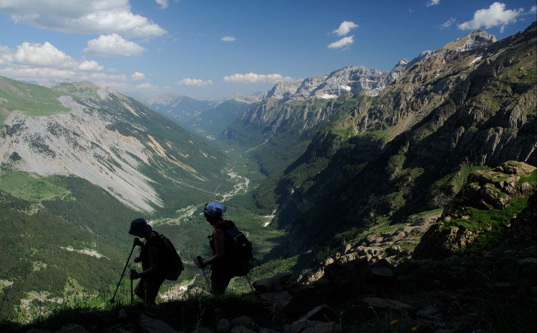
Evidence of the Ice Age (Geo-Route 8)
Duration: 3.5 hours. Difference in altitude: 400 m. Description: Around 65,000 years ago, a large part of the Pyrenees was under ice. Huge glaciers similar to those currently found in the Alps occupied the main Pyrenean valleys. Today only small masses of ice remain around the highest peaks of the Pyrenees. However, we can observe in the landscape numerous evidences of that "Ice Age": valleys, waterfalls, ibones, moraines, etc. were the result of the work carried out by the glaciers that, like enormous ice bulldozers, eroded the rocks and transported them down the valley, totally modifying the relief. By carefully observing the landscape, it is possible to deduce the existence and extent of those glaciers and the route between Viu and Broto is one of the best of the many options offered by the Sobrarbe-Pyrenees Geopark.
Balcony of Pineta (Geo-Route PN 6)
Duration: 5 hours (one way). Elevation gain: 1,200 m. Description: Long route that saves an important difference in altitude that corresponds to the threshold that separates the bottom of the Pineta Valley and the Tucarroya cirque. The 1,200 meters of height difference between both places must have been occupied by a spectacular ice waterfall that originated in this place at the height of the last glaciation, around 65,000 years ago. The path allows us to make numerous geological observations on the rocks, observing the effects of past glaciers, the meager masses of ice today and the tectonics of the Monte Perdido massif. The views from this place are magnificent, at the foot of the Monte Perdido glacier and with an almost aerial panoramic view of the entire Pineta valley and some of its tributaries such as La Larri. Several waterfalls, among which the Marboré and Cinca waterfalls stand out, dot the path.
Escuaín Valley ( PN 10 Geo-Route)
Duration: 4 hours (access on foot to the 3 viewpoints must be added the travel time between viewpoints by car) Slope: there is hardly any slope, in Revilla about 50 m. Description: Itinerary to travel by car that allows to know the Escuaín Gorge from different viewpoints. The Escuaín Gorge is one of the outstanding features of the Ordesa y Monte Perdido National Park and, nevertheless, it is the least visited valley in the park. This visit brings us closer to the understanding of the karstic phenomena, being able to visit a cave and approach one of the chasms with the greatest difference in height in the world. The itinerary is designed to travel in a private vehicle with short walks along easy and well marked mountain trails such as the viewpoints of Tella, Revilla and Escuaín viewpoints.
Mountain bike geo-routes
If you like mountain biking, the Geopark offers 13 routes marked according to difficulty, with geological stops where you can rest for a moment and delve into the mysteries of the past that has left its mark on the rocks of the Geopark.
MTB Geo-Route 5. From Aínsa to El Pueyo de Araguás
Duration: 2- 3 hours Elevation gain: 360 Technical difficulty: Easy-medium Description: It is a circular route, varied, entertaining and not too demanding. Along the route we will find three variants: the first (medium difficulty) is very interesting, since next to the path there is a circuit of jumps for MTB and an area of cyclable ravines and can also serve as a shortcut to shorten the route. The second variant (difficult) avoids, through the path PR-HU 43, a section of track. The third and last variant (difficult) is a magnificent and photogenic example of a path over marl ridges.
On the roadside
We invite you to follow this route, easily accessible from the main road network in Sobrarbe, to discover some of the basic elements of the geological heritage of the Geopark, through the interpretative tables that you will find at each point of interest, scattered throughout the Geopark.
A world in ruins (Laspuña-El Pueyo de Araguás Highway)
Location : Rest area on the road between Laspuña and El Pueyo de Araguás At the same time that the formation of a mountain begins, it starts to be destroyed by external geological agents (water, ice, wind, gravity, living beings?) that undertake their shaping action on the landscape. This generates rocky buildings with their own character and, frequently, of overwhelming beauty. When we admire these landscapes we are not aware that, in reality, we are observing the ruins of something much larger: an enormous geological edifice in destruction that will eventually disappear.